 |
 |
 |
 |
 |
- Welcome
- Search TravelJharkhand.com
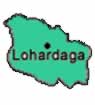 Lohardaga district came into existence after Ranchi was split into three districts namely Ranchi, Lohardagga and Gumla way back in 1983. The district is named after the town of Lohardaga, the administrative headquarters of the district. Lohardaga was given the position of a sub division in 1972 and a district in 1983. In Jain texts there is reference to Lord Mahavir's visit to Lore-a-Yadaga, which means 'river of tears' in Mundari. 'Ain-e-akbari', The famous book on Akbar, also mentions a place called 'Kismate Lohardaga'. The word Lohardaga may be made of two hindi words, Lohar meaning 'ironmonger', and Daga meaning center', which makes the literal meaning of Lohardaga as 'center of iron mining'.
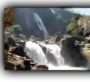
The district is situated in the south western part of Jharkhand State between 23°30' and 23°40' north latitudes and 84°40' and 84°50' east longitudes. The district covers an area of 1491 km² in the tribal belt of Chotanagpur plateau. It has five blocks namely Lohardaga, Kuru, Bhandra, Kisko and Senha. There are 353 villages spread over in 66 Gram Panchayats. Lohardaga had a total population of 3.64 lakh with a population density of 244 per square kilometre. Most of the villages except the hilly pockets of the district are connected with the roads. Electricity is supplied from Patratu Thermal Power Station which is in the Hazaribagh district. Out of 354 villages only 25 have rural electrification. The inhabitants of Lohardaga district mainly depend on agriculture, forest produce and seasonal migration to different parts of the country. 80% of the population depends upon agriculture. The main crop of this area is paddy. The main mineral resources of Lohardaga are laterite and bauxite.
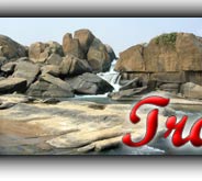
The district is classified into two physical divisions namely the Hilly Tract and the Plateau Region. The hilly tract is extended in the West and North-Western parts of the district which includes the parts of Kisko, Senha and Kuru development blocks. Sal forests accounts for major area in this region. The Plateau region is a part of the Gumla plateau, comprised of entire part of Lohardaga and Bhandra development blocks and some parts of Senha, Kuru and Kisko developments blocks.
Lohardaga is the only town in Lohardaga district which is also the capital of Lohardaga district of Jharkhand. In early 1900s Lohardaga was the commissionary headquarters for Chotanagpur. It was only later that the commissionary of Chotanagpur was shifted to Ranchi. The commissioner's office still exists and it houses the Lohardaga Municipality office.The town of Lohardaga has an average elevation of 647 metres (2122 feet). Lohardaga town has a population of 46,204 and has an average literacy rate of 71%, higher than the national average of 59.5%.
Lohardaga district has an annual average temperature is 23 degree centigrade and the district receives an annual average rainfall of 1000-1200 mm. The Major rivers flowing through Lohardaga district includes koyal, sankh, Nandani, sahi, fulshar etc.
Lohardaga's history dates way back to age of Lord Mahavira. Jain literature refers to Lord Mahavir's visit to a place called "Lore-a-Yadaga," a term that also appears in Mundari literature. lore-a-Ydaga' in Mundari means river of tears. There is reference to Kismate Lohardaga in .......................
Read more >> History of Lohardaga
Read more >> Lohardaga district - At a Glance
 The movement for a separate state of Jharkhand is an odyssey spread over a century which is traced back to the early 1900s, when Jaipal Singh, an Indian Hockey captain and Olympian, suggested the idea of a separate state consisting of the southern districts of Bihar. The idea did not become a reality, however, until August 2, 2000, when the Parliament of India passed the Bihar Reorganization Bill to create the state of Jharkhand, carving 18 districts .......
 Jharkhand has a population of 26.90 million, consisting of 13.86 million males and 13.04 million females. Like most of our states Jharkhand is also a melting pot where people from different parts of the country have come and settled down. The population consists of 28% tribes, 12% Scheduled Castes and 60% others. There are 32 different tribal communities, major one being Santhals, Oraons, Mundas and Hos. Other tribes include Asur, Baiga, Banjara, Bathudi, Bedia, Binjhia, ......
Jharkhand's culture is rich and diverse and as a result unique in its very own way. Archeaologists have unearthed pre-Harappan pottery, pre-historic cave paintings and rock-art from various parts of Jharkhand. That hint at ancient, cultured civilizations inhabiting these parts. The intricate woodwork, the pitkar paintings, tribal ornaments, stone carvings, dolls and figurines, masks and baskets, all are pointing towards the cultural wealth of Jharkhand existed even before the ........
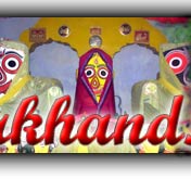
Various religious fairs and festivals celebrated in Jharkhand. Barura Sharif, Belgada Mela Simaria, Bhadli Mela Itkhori, Chatra Mela, Kolhaiya Mela Chatra, Kolhua Mela Hunterganj, Kunda Mela Pratappur, Kundri Mela Chatra, Lawalong Mela, Rabda Sharif, Sangat and Tutilawa Mela Simaria are some of the prominent fairs and festivals of Jharkhand. Specific festivals of the tribes are Karma, Manda, Sarhul, Jani shikar, Bandna etc. Sarhul is the spring festival where Sal tree .......
Jharkhand's culture is rich and diverse and as a result unique in its very own way. Archeaologists have unearthed pre-Harappan pottery, pre-historic cave paintings and rock-art from various parts of Jharkhand. That hint at ancient, cultured civilizations inhabiting these parts. The intricate woodwork, the pitkar paintings, tribal ornaments, stone carvings, dolls and figurines, masks and baskets, all are pointing towards the cultural wealth of Jharkhand existed even before the ........
Jharkhand's culture is rich and diverse and as a result unique in its very own way. Archeaologists have unearthed pre-Harappan pottery, pre-historic cave paintings and rock-art from various parts of Jharkhand. That hint at ancient, cultured civilizations inhabiting these parts. The intricate woodwork, the pitkar paintings, tribal ornaments, stone carvings, dolls and figurines, masks and baskets, all are pointing towards the cultural wealth of Jharkhand existed even before the ........
Jharkhand has a population of 26.90 million, consisting of 13.86 million males and 13.04 million females. Like most of our states Jharkhand is also a melting pot where people from different parts of the country have come and settled down. The population consists of 28% tribes, 12% Scheduled Castes and 60% others. There are 32 different tribal communities, major one being Santhals, Oraons, Mundas and Hos. Other tribes include Asur, Baiga, Banjara, Bathudi, Bedia, Binjhia, ......
Jharkhand's culture is rich and diverse and as a result unique in its very own way. Archeaologists have unearthed pre-Harappan pottery, pre-historic cave paintings and rock-art from various parts of Jharkhand. That hint at ancient, cultured civilizations inhabiting these parts. The intricate woodwork, the pitkar paintings, tribal ornaments, stone carvings, dolls and figurines, masks and baskets, all are pointing towards the cultural wealth of Jharkhand existed even before the ........
Various religious fairs and festivals celebrated in Jharkhand. Barura Sharif, Belgada Mela Simaria, Bhadli Mela Itkhori, Chatra Mela, Kolhaiya Mela Chatra, Kolhua Mela Hunterganj, Kunda Mela Pratappur, Kundri Mela Chatra, Lawalong Mela, Rabda Sharif, Sangat and Tutilawa Mela Simaria are some of the prominent fairs and festivals of Jharkhand. Specific festivals of the tribes are Karma, Manda, Sarhul, Jani shikar, Bandna etc. Sarhul is the spring festival where Sal tree .......
Jharkhand's culture is rich and diverse and as a result unique in its very own way. Archeaologists have unearthed pre-Harappan pottery, pre-historic cave paintings and rock-art from various parts of Jharkhand. That hint at ancient, cultured civilizations inhabiting these parts. The intricate woodwork, the pitkar paintings, tribal ornaments, stone carvings, dolls and figurines, masks and baskets, all are pointing towards the cultural wealth of Jharkhand existed even before the ........
Jharkhand's culture is rich and diverse and as a result unique in its very own way. Archeaologists have unearthed pre-Harappan pottery, pre-historic cave paintings and rock-art from various parts of Jharkhand. That hint at ancient, cultured civilizations inhabiting these parts. The intricate woodwork, the pitkar paintings, tribal ornaments, stone carvings, dolls and figurines, masks and baskets, all are pointing towards the cultural wealth of Jharkhand existed even before the ........Home Must see spots Hotels Travel Agencies Advertise with us Contact Feed Back COPYRIGHT © 2008 TravelJharkhand.com | | Designed and Developed by GIGISOFT Solutions |